GIS Insights & Community Articles
Expert tutorials and AI-powered geographic analysis from the MapKmlTools community.
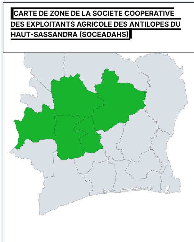
Carte SOCEADAHS: Zones Agricoles et Écosystèmes en Haut-Sassandra
Découvrez la carte détaillée de la SOCEADAHS en Haut-Sassandra, Côte d'Ivoire, incluant exploitations, infrastructures et zones à risques.
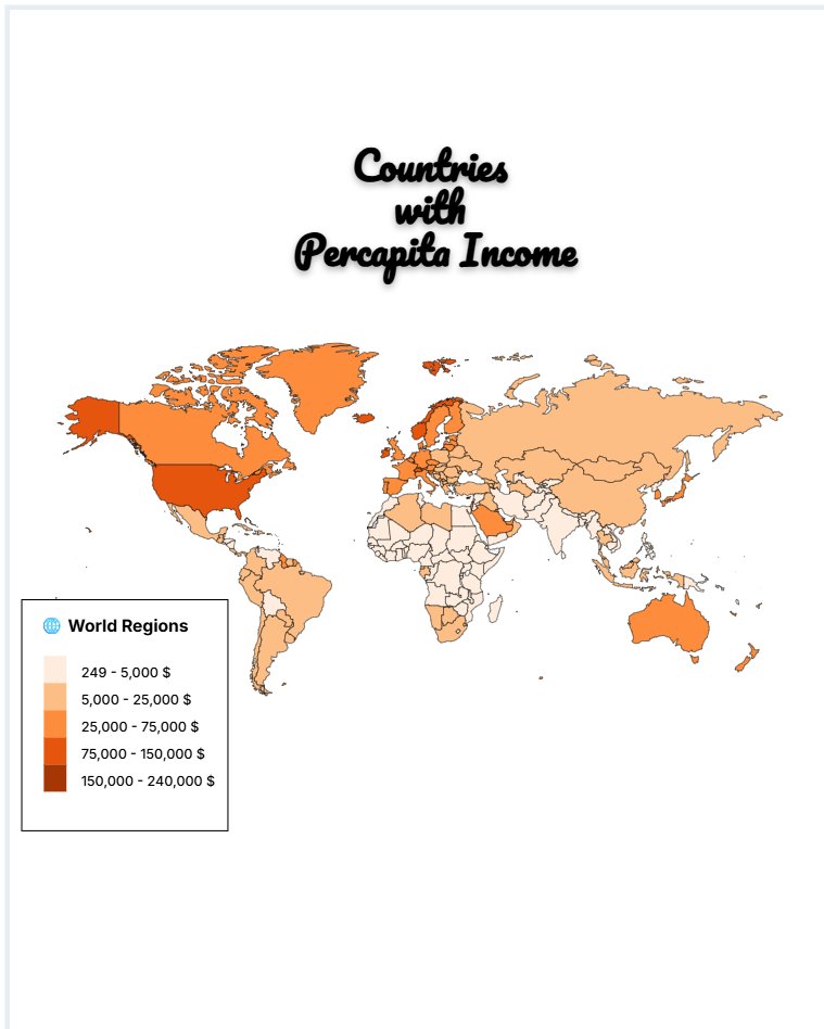
Global Per Capita Income: Mapping Wealth Across World Regions
Explore global per capita income trends across world regions. Discover wealth disparities, economic insights, and regional growth patterns in this detailed analysis.
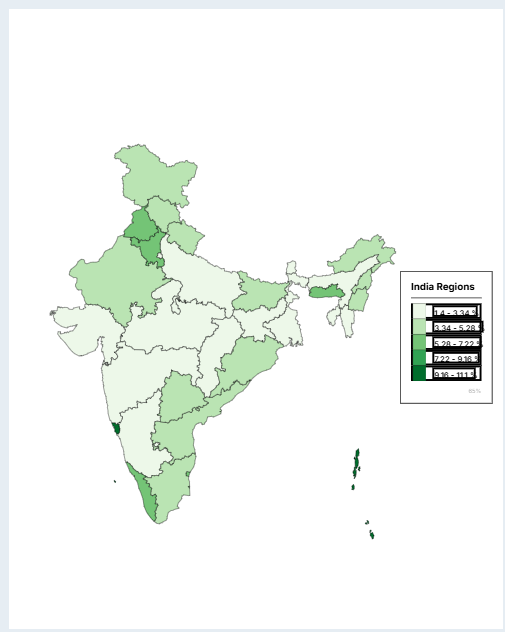
India's Unemployment Crisis: State-by-State Analysis 2024
Explore India's unemployment rates by state in 2024. Compare top performers, analyze trends, and discover economic insights for key regions.
India’s Political Landscape: Ruling Parties by State & Union Territory 2024
Explore India’s political map in 2024: ruling parties, alliances, and key trends across 36 states and union territories. Data-driven insights and analysis.

How to Create Kml from CSV or Excel for free fully online
Thinking to Create kml from CSV or Excel file? Its more easy and even fully offline and free - use Mapkmltools.com online tool called "Smart Excel & CSV to KML Converter"

How to Trace an Image Map into a CAD Drawing (DXF)
Convert satellite photos, drone maps, and scanned floor plans into editable CAD files effortlessly using an online image tracing tool.

How to Calculate the Area of an Image Map
Learn how to accurately measure real-world acreage or square meters directly from satellite screenshots, drone photos, and scanned plans.

Free XYZ Tile Map Providers: The Complete 2025 Guide
Discover the best free XYZ tile map providers for GIS, QGIS, Leaflet, and web mapping. Get direct tile URLs for OpenStreetMap, Esri, CartoDB, Stamen, and more.

Top 5 Free Online KML Editors in 2026
Looking for a Google Earth alternative? We review the best free tools to view and edit KML files directly in your browser.
Top 5 Free Online KML Editors in 2026
Looking for a Google Earth alternative? We review the best free tools to view and edit KML files directly in your browser.

KML vs GeoJSON: Which Format Should You Use?
Confused between KML and GeoJSON? We compare the two most popular GIS formats to help you decide which is best for your mapping project.

How to Create Buffers Around KML Features
Learn how to generate accurate radius buffer zones around points, lines, and polygons in your KML files for proximity analysis.
Quickly Create Maps Online Without Software
Need to draw a quick map? Use our free online mapping tool to plot points, lines, and polygons and export them to KML.
Convert KML to GeoJSON for Web Mapping
Transitioning from Google Earth to web maps? Convert your KML/KMZ files to standard GeoJSON format for Leaflet, Mapbox, and OpenLayers.

How to Merge Multiple KML Files Into One
Stop switching between files. Combine multiple KML or KMZ maps into a single, organized master file with our free KML Merger.

Optimize KML Files by Simplifying Geometry
Reduce KML file size and speed up Google Earth by simplifying complex polygon and line vertices without losing shape.
Bulk Convert Coordinates to Addresses (Reverse Geocoding)
Turn a list of GPS coordinates into human-readable city and street addresses instantly with our free bulk reverse geocoding tool.
Convert Between DD, DMS, UTM, and MGRS Coordinates
Easily convert location data between Decimal Degrees, Degrees Minutes Seconds, UTM zones, and MGRS military grids.

How to Convert Shapefiles to KML for Google Earth
Need to view GIS data in Google Earth? Learn how to convert ESRI Shapefiles (.shp) to KML format with attributes preserved.
View CAD Drawings in Google Earth (DXF to KML)
Overlay your CAD engineering drawings onto real-world maps. Convert DXF files to KML with accurate georeferencing.

Convert GeoTIFF Imagery to KML SuperOverlays
Display high-resolution drone imagery or analysis results in Google Earth by converting GeoTIFF rasters to tiled KML SuperOverlays.

How to Edit a KML File Online (Free Tool)
Need to make quick changes to a KML map? Learn how to edit names, colors, and coordinates directly in your browser without installing Google Earth.
How to Convert Excel (XLSX) and CSV to KML
Turn your spreadsheet of addresses or coordinates into a Google Earth map. A complete workflow for mapping Excel data.

How to Calculate Usage Area from KML Polygons
Accurately measure the acreage or square kilometers of multiple polygons in your KML file instantly.